


033 Le Barp Moustey Lavigne

lucille
User
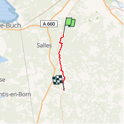

Length
31 km

Max alt
85 m

Uphill gradient
261 m
Km-Effort
34 km

Min alt
31 m

Downhill gradient
287 m
Boucle
No
Creation date :
2014-12-10 00:00:00.0
Updated on :
2014-12-10 00:00:00.0
7h28
Difficulty : Unknown

FREE GPS app for hiking
 SityTrail
IGN / Geographical institutes
SityTrail Plus
The world is yours!
About
Trail Walking of 31 km to be discovered at New Aquitaine, Gironde, Le Barp. This trail is proposed by lucille.
Description
Le Barp / Moustey Lavigne
Camping Arial de la vigne
Positioning
Country:
France
Region :
New Aquitaine
Department/Province :
Gironde
Municipality :
Le Barp
Location:
Unknown
Start:(Dec)
Start:(UTM)
677988 ; 4940815 (30T) N.
Comments